


Are you wasting time searching for a cart, tool, crate, pallet, mobile equipment or critical part? Do you lack visibility of the actual movement of your assets between zones, buildings or sites? Do you also need to know who is present in a sensitive area in the event of an alert or evacuation?
Industrial geolocation responds to these challenges by giving a usable position to assets, equipment, vehicles, containers and, when justified, to people present on site.
The aim is not to “track for the sake of tracking”. The aim is to transform a position into useful information: to recover an asset, reduce losses, secure interventions, automate a change of status, trigger an alert or document proof of an event.
CIPAM supports manufacturers, logisticians and sensitive sites in the selection, deployment and integration of RTLS solutions: BLE, UWB, active RFID, LoRa, Wi-Fi RTLS, outdoor GPS, badges, tags, antennas, kiosks, supervision, middleware and connection to existing systems.
Need to geolocate your assets or secure your teams in real time?
Choice of technology according to precision, environment, autonomy and budget
Deployment: tags, badges, terminals, antennas, supervision and middleware
Personnel security: PTI / DATI, evacuation, census, sensitive areas
ERP, WMS, MES, CMMS, BMS or HSE supervision connection
Contents
- Asset geolocation or personal security
- BLE, UWB, active RFID, LoRa: which technology to choose?
- Personnel safety and sensitive sites
- Location of industrial assets
- Connecting localization to your IS
- CIPAM case studies
- Technology choice matrix
- RGPD and staff location
- FAQ industrial geolocation
Asset geolocation or personal security: two uses, two levels of requirement
Industrial geolocation covers two families of needs. The first concerns assets: forklifts, tools, containers, equipment, vehicles, critical parts or mobile resources. The second concerns people: isolated workers, those working in sensitive areas, teams present on a high-risk site, or personnel to be counted in the event of evacuation.
The technologies may be similar, but the objectives are different. For an asset, the priority is often availability, loss reduction and flow optimization. For a person, the priority becomes safety, the purpose of treatment, respect for the social framework and the ability to trigger rapid intervention.
Going further : identify and locate people and identify your assets and flows.
BLE, UWB, active RFID, LoRa: which technology for which use?
Technology flows from need, not the other way round. Accuracy, autonomy, infrastructure density, radio constraints, metal environment, indoor/outdoor coverage and level of IS integration must all be analyzed before choosing.
In many of CIPAM’s industrial localization projects, BLE covers localization needs by area or proximity with an excellent cost/value ratio. UWB becomes relevant when decimetric or centimetric precision is really required.
See also : RTLS solutions, UWB, BLE, LoRa and active RFID.
Locate a truck. Protect an operator. Prove evacuation. Three different challenges, but the same logic: transforming a position into an exploitable event.
Personnel safety: locate to alert, identify and intervene faster
On sensitive sites, personnel location can reinforce HSE systems: identification in the event of evacuation, location of a lone worker, alert in a restricted area, monitoring of an incident or assistance with rescue operations.
It does not replace risk analysis, HSE procedures or rescue organization. It does, however, provide an additional layer of information about who is present, where to intervene and how to document events.
The most useful functions :
- Automatic zone census: find out who is present in a zone, building or assembly point;
- Entry/exit alerts: detect access to unauthorized or sensitive areas;
- PTI / DATI: manual alert, loss of verticality, prolonged immobility or absence of movement ;
- Evacuation dashboard: real-time visualization of presence by zone;
- Usable history: log of alerts, events, passages and acknowledgements.
To find out more : staff census and location solution and geolocation and personal safety.
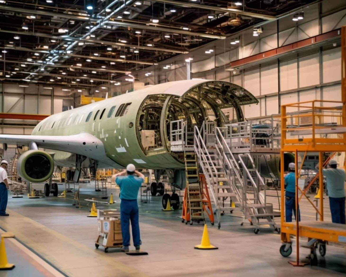
Geolocate your assets: find, track and automate flows
Asset geolocation reduces search times, minimizes losses, improves equipment availability and feeds business systems with reliable events.
The assets concerned may be :
- forklifts ;
- AGVs, mobile robots and site vehicles;
- critical tooling ;
- reusable containers ;
- pallets, bins, shuttle cases ;
- maintenance equipment ;
- sensitive parts or batches during production.
The value does not only come from the card. It comes from the associated business rule: “the asset has entered the shipping zone”, “the tool has left its authorized zone”, “the container is immobilized for too long”, “the vehicle is available”, “the equipment has returned for maintenance”.
See also : connected forklift, RFID tool tracking and reusable container management.
Connect location to your ERP, WMS, MES or CMMS
A position displayed on a map is useful. A position transformed into a business event is much more powerful.
CIPAM can connect location data to your existing systems to automate status, trigger alerts, update a location, generate proof or feed a dashboard.
Going further : integrate your existing environments and and make the most of field data.
CIPAM case studies: 6 contexts, 6 field approaches
The examples below are based on CIPAM case studies and feedback. The results observed depend on the context: type of site, number of assets monitored, technology chosen, existing infrastructure, level of IS integration and adoption by field teams.

In a CIPAM case study on a sensitive site, census time in an evacuation situation was cut from around 45 minutes to less than 2 minutes, thanks to automatic detection by zone and real-time supervision.
Objective: reinforce the safety of workers, speed up census and improve HSE traceability.

On a CIPAM logistics project, BLE localization of carts and mobile equipment reduced search times by 85% and improved the availability of field resources.
Objective: reduce downtime, visualize available equipment and make internal flows more reliable.
In an industrial environment with stringent quality requirements, locating critical tooling has enabled us to limit stoppages due to missing tools, and to better control when tools leave authorized zones.
Objective: guarantee the availability of qualified tooling at the right station, and secure the traceability of production resources.
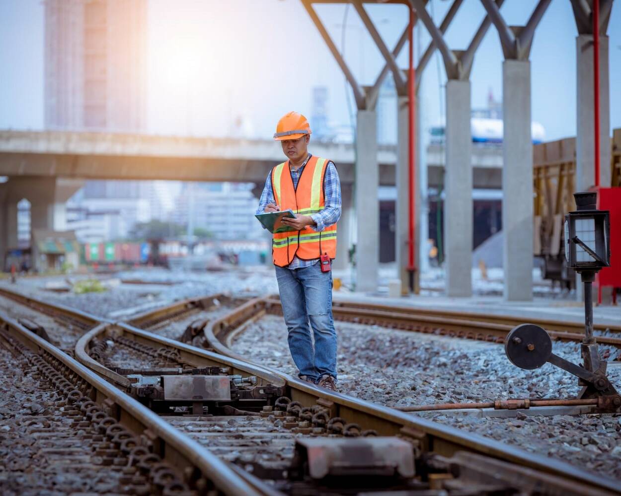
On a railway project, the detection of active badges by zone has improved visibility of the presence of workers and reduced the time needed to make the system safe.
Objective: to protect agents in high-risk zones and provide reliable information to the supervision station.
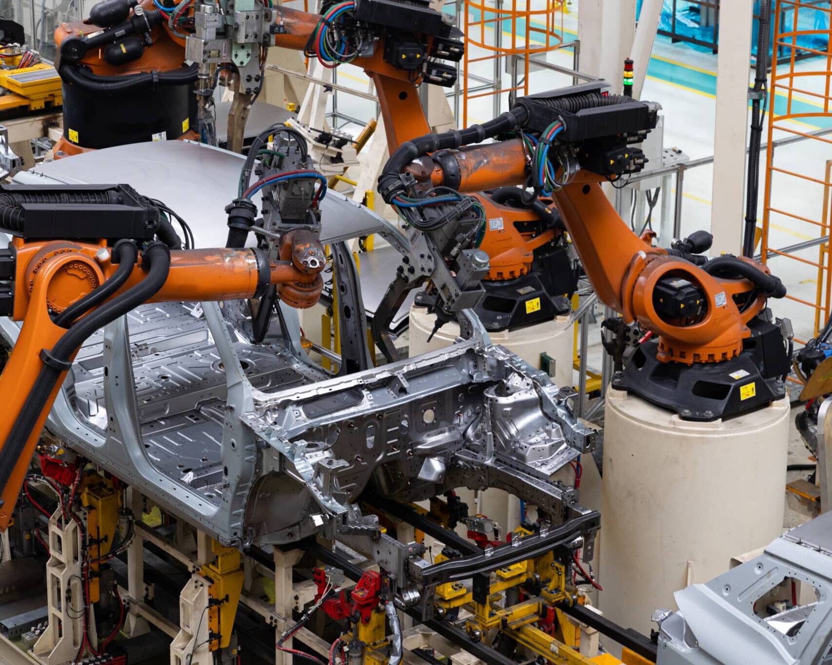
In a context of human/machine cohabitation, a UWB solution has enhanced control of traffic zones. Since commissioning, no collision incidents have been reported within the monitored perimeter.
The aim is to ensure safe traffic flow, reliable positioning and better control of interactions between operators and mobile equipment.

On an extensive site, a PTI / DATI solution combined with long-range technology has enabled us to cover isolated areas and significantly reduce response times in the event of an alert.
Objective: protect isolated workers, speed up response and keep a usable history of alerts.
Technology choice matrix
RGPD and staff localisation: framing the system from the outset
Personnel geolocation must be handled methodically. It’s not the badge or the technology that is “compliant” by nature: it’s the entire system, its purpose, settings, accesses and retention rules that need to be framed.
For use related to safety, isolated work or evacuation, the project must specify :
- purpose: safety, census, emergency response, protection of lone workers;
- Collected data: position by zone, timestamp, alert, acknowledgement, history;
- persons authorized to consult the information ;
- event retention time;
- employee information and framework for use ;
- the separation between safety supervision and individual monitoring.
CIPAM can work with your HSE, IT, HR and operations teams to define the technical framework of the system, so as to reconcile safety, operational efficiency and compliance with the internal framework.
CIPAM: industrial geolocation, field security and IS integration

Why CIPAM?
An industrial geolocation project is rarely just about beacons. It’s a project of mapping, radio, business use, field interface, IS integration and team adoption.
CIPAM supports the project from start to finish:
- needs audit and site mapping ;
- choice of appropriate technology: BLE, UWB, active RFID, LoRa, Wi-Fi RTLS, GPS ;
- infrastructure deployment: terminals, antennas, gateways, tags, badges, etc;
- field tests: coverage, accuracy, autonomy, radio constraints ;
- supervision interface, alerts and dashboards ;
- IS integration: ERP, WMS, MES, CMMS, BMS or HSE supervision;
- training for users and security teams ;
- maintenance, after-sales service, upgrades and long-term support.
This approach avoids the classic errors of oversized technology, poorly positioned infrastructure, unused data, isolated IS interfaces or badges unsuited to the field.
Describe your industrial geolocation needs
Assets, personnel, sensitive areas, warehouses, extended sites, carts, tools, containers, PTI / DATI or IS integration: describe your context and CIPAM will help you frame the right architecture.
Site audit and needs mapping
Technology selection and real-life testing
Deployment, supervision, alerts and IS integration
Maintenance, field support and upgrades
FAQ
Frequently asked questions before an industrial geolocation project.
RTLS refers to the technical system used to locate assets or people in real time. Geolocation corresponds to usage: knowing where a resource is. Tracking adds a notion of follow-up over time, with a history of positions, passages or events.
BLE is relevant for localization needs by area, proximity or presence, with a good cost/value ratio. UWB is preferable when decimetric or centimetric precision is essential: AGVs, robots, dense areas or highly critical tooling.
Not always as a mandatory technology. On the other hand, sensitive sites need to organize prevention, evacuation, rescue and risk management. A tracking solution can help to identify, protect and alert isolated workers, and ensure traceability of HSE events.
Yes, and that’s where much of the value lies. Position becomes a business event: entry into a zone, exit from a building, abnormal immobilization, maintenance return, shipment or presence in a sensitive area.
ROI depends on the number of assets tracked, initial search time, cost of losses, criticality of equipment and level of IS integration. In several CIPAM case studies, gains linked to reduced search times, reduced equipment losses and improved asset availability have resulted in ROIs of less than 12 months.
Yes, but only for a clear, proportionate and documented purpose: safety, evacuation, isolated work or emergency intervention. The system must provide for employee information, limited access to data, a justified retention period and use in accordance with the company’s internal framework.
Further information
- RTLS solutions
- UWB Solutions
- BLE Solutions
- LoRa solutions
- Active RFID
- Identify and locate people
- Connected forklift
- RFID tool tracking
- Management of reusable containers
- Identify assets and flows
- Acquiring field data
- Integrate your existing environments
- Maintenance and after-sales service